Monitoring the UK climate and forecasting its meteorological changes with analysis
UK Climate Forecasting and Analysis

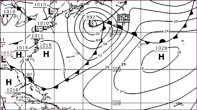
Climate Forecast Stormy Atlantic Ocean UK Weather Analysis and Reports Climate & Air Quality Jet Stream

Tropical Storms and Atlantic Hurricanes
Hurricane Names for the 2026 Season starting on the 1 June
Arthur Bertha Cristobal Dolly Edouard Fay Gonzalo Hanna Isaias Josephine Kyle Leah Marco Nana Omar Paulette Rene Sally Teddy Vicky Wilfred

Tropical Waves on Monday 1 June
1. An eastern Atlantic tropical wave is along 32W, south of 12N and moving westward at 10 to 15 kt. Convection is described in the monsoon trough/ITCZ section below.
2. A central Caribbean tropical wave is along 73W, south of 17N and moving westward at 10 to 15 kt. Relatively dry air over the basin is precluding convection near this wave at this time.
3. A western Caribbean tropical wave is along the coast of Nicaragua near 83W, south of 15N and moving westward at around 15 kt. Scattered moderate convection extends from western Panama to southeast Nicaragua.
Tropical waves in the Atlantic develop from low-pressure disturbances which develop as far east as Sudan in east Africa and drift across the continent into the Atlantic Ocean. These are generated or enhanced by the African Easterly Jet. The clockwise circulation of the large transoceanic high-pressure cell or anticyclone centred near the Azores islands (known as the Azores High) impels easterly waves away from the coastal areas of Africa towards North America. Tropical waves are the origin of approximately 60% of Atlantic tropical cyclones and of approximately 85% of intense Atlantic hurricanes. Tropical cyclones can sometimes degenerate back into a tropical wave. This normally occurs if upper-level wind shear is too strong. The storm can redevelop if the upper-level wind shear abates. If a tropical wave is moving quickly, or is organised enough it can have winds of a strength in excess of tropical storm force but it is not considered a tropical storm unless it has a closed low-level circulation. An example of this was Hurricane Claudette in 2003 where the original wave had winds of 45 mph before developing a closed low-level circulation. Another factor is the Saharan Air Layer which can influence the formation of tropical storms and hurricane activity. Its dry dusty air can suppress tropical cyclone formation by promoting downdrafts and increasing vertical wind shear while its warmth stabilizes the atmosphere and reduces cloud formation. Dust particles are usually transported at altitudes between 1 and 3 miles (1,500–15,000 feet) above the surface at a speed of 25 to 55 mph. The dust also affects air quality and can contribute to haze in regions far from the Sahara such as the UK when transported by strong upper-level winds

UK Climate Forecast 38 Union Street Grantham Lincolnshire NG31 6NZ