Monitoring the UK climate and forecasting its meteorological changes with analysis
UK Climate Forecasting and Analysis

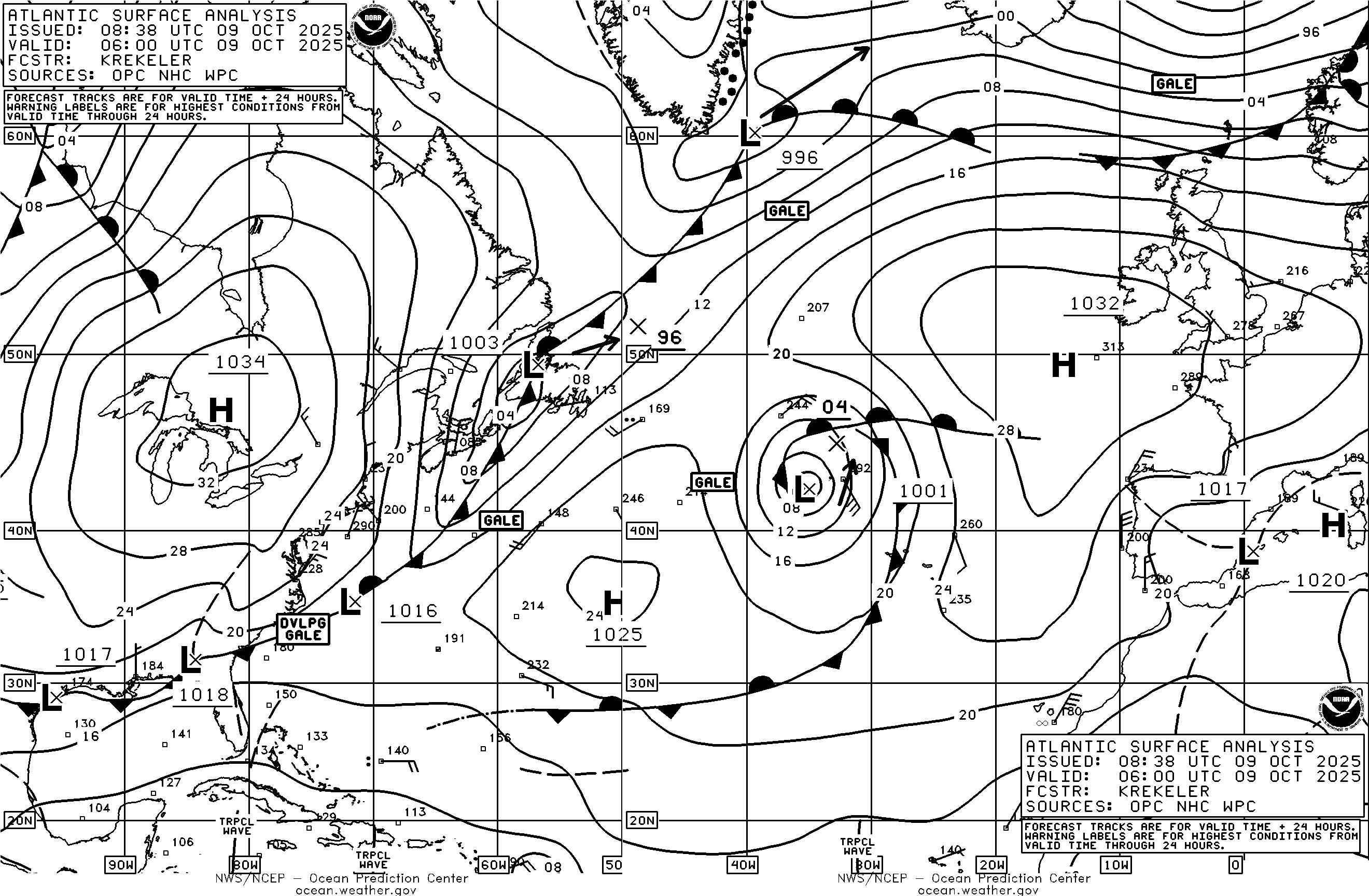
Climate Forecast Stormy Atlantic Ocean UK Weather Analysis and Reports Climate & Air Quality Jet Stream


Netweather radar
updated every 5 minutes.
Click on the map

The data and charts on this page are supplied mainly by the Icelandic Met Office which is under the auspices of the Ministry for the Environment and Natural Resources based on the Icelandic Meteorological Office and the Icelandic Hydrological Survey. The Icelandic Meteorological Office has 135 full-
Temperature Precipitation and Cloud charts for Tuesday 2 June -


UK Climate Forecast 38 Union Street Grantham Lincolnshire NG31 6NZ
UK Daily Weather Extremes
Yesterday the highest maximum temperature of 24.7 C was recorded at Teddington Bushy Park a royal London park of 1100 acres within the postal district of Teddington. The lowest minimum temperature of 6.5 C was recorded at Altnaharra a small hamlet in the Scottish Highlands. The highest rainfall of 21.2 mm was recorded at Kirkwall the largest town in Orkney. The sunniest place was Wittering with 9.5 hours of sunshine.


Weather Online: Monday 1 June
Southeastern England will be dry and bright much of the day, early sun giving way to building cloud from the west. Rain from before dawn in Ireland and western Scotland spills eastwards and extends over Wales then western England in the morning, reaching central counties by the middle of the day. Rain setting in more persistently heavier for Wales, Cumbria and southwest England. Rain clears for Ireland, leaving showers. Fresh southwesterly winds. Highs 15C west, to 20C east. Night: Rain continues to extend eastwards in the evening, heavier falls developing for central-
Weather Online: Tuesday 2 June
A rather cloudy start with a few showers mostly in the west, becoming more widespread through the morning and middle of day into central areas, drifting eastwards. Some heavy and thundery bursts later focused toward eastern England and Scotland, also Northern Ireland, gradually easing toward dusk. More sun will break out in western areas later afternoon. Westerly wind strengthens across Ireland and southwest Britain. Highs of 16 to 18C for most areas, slightly milder east England.
Weather Online: Wednesday 3 June
During Wednesday morning, an area of persistent rain will arrive from the west, affecting Ireland from before dawn. Rain will be heavier for a few hours for Wales and western parts of England and Scotland. Eastern England likely stays dry until midday or early afternoon, but several hours of heavy showery rain will reach most areas. The rain staying most persistent in the northwest, risk heavy again later. Fresh southwesterly winds, strongest south. Highs 15 to 20C, warmest southeast.
Met Office Friday 5 June to Sunday 14 June
Changeable early in this period with Atlantic frontal systems moving across the UK. These will bring showers or longer spells of rain at times, with wettest conditions in the northwest, driest in the southeast. Strong winds may affect parts of the UK at times, especially the northwest. Later in the period, higher pressure and drier weather may begin to become more prevalent, especially in the south. Temperatures are likely to be near normal overall.

Zoom Earth Live Weather Satellite
Monday 1 June: At 01.00 hrs Shoeburyness is reporting a temperature of 15.2 C with Langdon Bay 15.2 C and 15 C at London Heathrow and Birmingham Airports. The Cairnwell is reporting winds of 26 mph. Aonach Mor is reporting a temperature of 4.7 C with a dewpoint of 4.6 C. At 02.00 hrs the London City Airport is reporting 16 C with Crosby 15.7 C. The Cairngorm Mountain is reporting winds of 35 mph. At 03.00 hrs the Channel Buoy is reporting a temperature of 15 C with SW winds of 7 knots 91% humidity and air pressure of 1019 Mb -

UK Flooding Atlantic Hurricane Activity